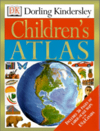
Dorling Kindersley's Children's Atlas
DK, September, 2000.
Hardcover, 160 pages.
ISBN: 0789458454
Ages 9-12
 With all of the recent geopolitical upheaval of the last twenty years,
the necessity of a good, detailed, accurate atlas cannot be overstated.
Now DK has revised and updated its children's atlas, with fantastic
results. The large atlas contains more than 50 innovative
three-dimensional computer-generated maps, informative text, and over
1,000 photographs, illustrations, and diagrams. The maps are
organized by continent. Each region is depicted in a detailed and
informative double-page layout which demonstrates the geography
of the continent. Within the continent, the region is divided by
country or group of countries. There is also a glossary and index
with more information about each country. Each double page spread
features interesting facts and beautiful photographs about the region
under study. Although the book is called a children's atlas, it would
still make a wonderful reference book for an adult, as well.
This is a must-have for the family library, especially if you have
school-age children.
Dorling Kindersley's Children's Atlas is available for purchase on Amazon.com
Note: We may receive a commission from sales made through product links in this article.
This review was published in the March, 2001 of The Internet Writing Journal.
Copyright © Writers Write, Inc. All Rights Reserved.
