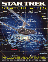
Star Charts: The Complete Atlas of Star Trek
Pocket Books, October, 2002.
Trade paperback, 95 pages.
ISBN: 0743437705
 Just in time for the upcoming Nemesis feature film,
Geoffrey Mandel provides Trekkers with
the ultimate star chart resource. Printed on
high-quality, glossy thick paper are multiple
illustrations showing the location of all the
known worlds of Star Trek: from Terra to
Qo'nos (the Klingon homeworld) to
the far reaches of the Gamma quadrant.
Our system, the Sol System in the Alpha Quadrant,
is beautifully illustrated, as is the Cardassian Union,
the Romulan Star Empire, the Klingon Empire and
many, many others.
Also included are the routes of every voyage
made by the Federation during all of the
various Star Trek series. The maps are beautifully
illustrated with excellent production values.
The "you are here" feature allows you to start
at Terra and see where all the other species in
the Star Trek universe live, in relation to
the Earth. This is an absolute must-have for
Star Trek fans.
Star Charts: The Complete Atlas of Star Trek is available for purchase on Amazon.com
Note: We may receive a commission from sales made through product links in this article.
This review was published in the October - November, 2002 of The Internet Writing Journal.
Copyright © Writers Write, Inc. All Rights Reserved.
